Our history
We apply innovative technological solutions to improve the conditions of service for users, help to ensure the safety and relevance of the materials of the fund. Our entire team is focused on the informatization of the economy and society, the provision and dissemination of spatial data!
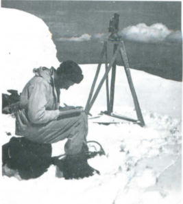
The period from 1960 to 1970 is characterized by significant scientific and technological progress in all processes of topographic and geodetic works: fundamentally new stereo photogrammetric devices, laser light-emitting diodes, high-precision optical theodolites, stereo comparators, etc. appeared. As a result, by 1970, the construction of a continuous astronomical and geodetic network was completed on the territory of Kazakhstan. The altitude base is significantly thickened on the basis of leveling of classes 1 and 2, and about 80% of the territory of the republic is covered by topography at a scale of 1:25,000. Work has begun on updating the 1:50,000 and 1:100,000 scale maps. this was caused by significant changes in the area due to the rapid development of productive forces, the construction of new settlements and roads, especially in areas of virgin land development. In 1972, the creation of geodynamic polygons began to study the deformations of the earth’s crust, determine the values of modern movements of the earth’s surface and search for possible precursors of earthquakes. Since the late 70s, space photography materials have been used to update maps and perform surveys in hard-to-reach areas.
In 1992, the Main Department of Geodesy and Cartography under the Cabinet of Ministers of the Republic of Kazakhstan was formed, which consisted mainly of specialists of the enterprise. During the same period, the reorganization of the enterprise began: all the expeditions were transformed into independent enterprises, only cameral production remained in the enterprise itself, and some production processes were reduced, and there was a significant reduction in the number of employees. At the end of 1996, a contract was signed for the creation of topographic maps with the Japanese International Cooperation Agency “Project for the settlement of irrigation and drainage and water systems in Kzyl-Orda” with the continuation of the contract in 1998 for the preparation for the publication of the original maps; since the end of 1998, the company worked with the same agency under the contract “Urgent creation of cartographic and geodetic data in the Southern region of the Republic of Kazakhstan”. Cooperation with the same agency continued in 2007: the company carried out work on the creation of topographic map data at a scale of 1:10,000 and basic GIS data for the project “Research for risk management related to seismic disasters in Almaty, Republic of Kazakhstan”.
The Republican State State Enterprise “National Cartographic and Geodetic Fund” of the Agency of the Republic of Kazakhstan for Land Management was renamed from 08.02.2013 into the Republican State State Enterprise “National Cartographic and Geodetic Fund” of the Committee for Land Management of the Ministry of Regional Development of the Republic of Kazakhstan. (Resolution of the Government of the Republic of Kazakhstan No. 109 of 08.02.2013). The Committee for Construction and Housing and Communal Services of the Ministry of Regional Development of the Republic of Kazakhstan and the Committee for Land Management of the Ministry of Regional Development of the Republic of Kazakhstan by merging into the Committee for Construction, Housing and Communal Services and Land Management of the Ministry of National Economy of the Republic of Kazakhstan. (Resolution of the Government of the Republic of Kazakhstan No. 993 of 15.08.2014).
Reorganization in accordance with the procedure established by law, the Republican State-Owned Enterprise “Kazgeodeziya” and “National Cartographic and Geodetic Fund”, which are under the jurisdiction of the Committee of Geodesy and Cartography of the Ministry of Digital Development, Innovation and Aerospace Industry of the Republic of Kazakhstan, by merging and transforming into a Republican state enterprise on the Right of economic management “National Center of Geodesy and Spatial Information” of the Committee of Geodesy and Cartography of the Ministry of Digital Development, Innovation and Aerospace Industry of the Republic of Kazakhstan.

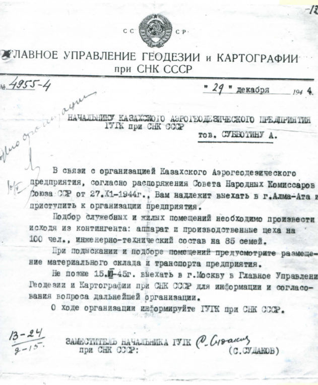
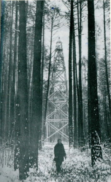
The creation of a topographical and geodetic enterprise in the republic, the successor of which is the modern branch of “ҰКГҚ”, was started in the first half of the 20th century. The legal document of the formation of the enterprise, called the Kazakh Aerogeodesic, is the order of the Main Department of Geodesy and Cartography under the Council of People’s Commissars of the USSR No. 795 of 27.11.1944, the official start date is 01.01.1945. The company was assigned the task of completing the survey of the territory of Kazakhstan on a scale of 1:100,000 by 1947, and then begin to perform surveys on a larger scale.
By 1950, the company was formed into an independent production unit, capable of performing all the work processes necessary for the creation of topographic maps, including preparation for publication.
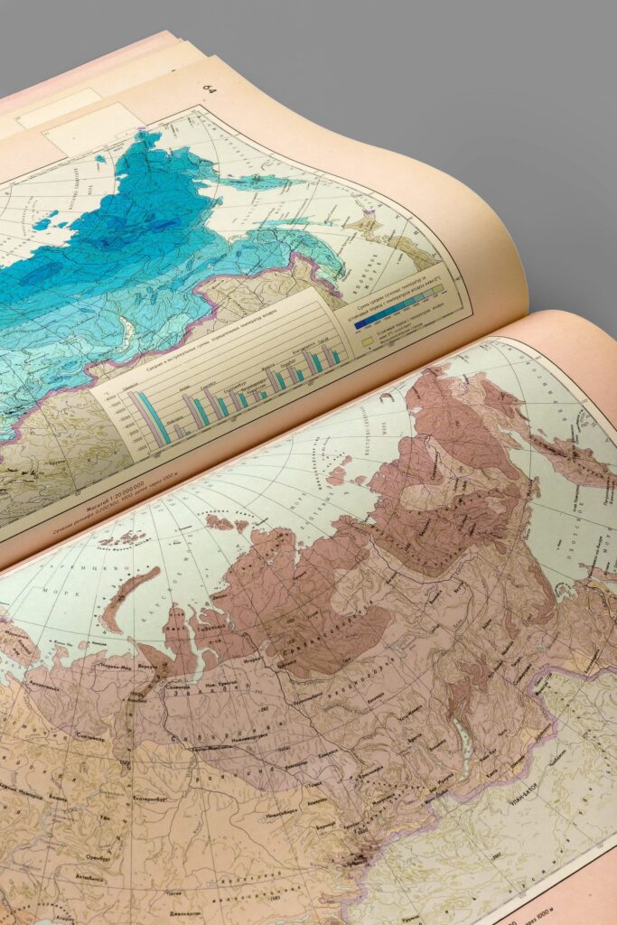
Since 1980, the company began to survey the bottom of reservoirs, and it became mandatory to display the bottom relief on the produced maps. To study the actual state of the Aral Sea in connection with its significant shallowing, a set of thematic maps was compiled, which, based on satellite imagery, show the position of the coastline for several years with a forecast of possible further shallowing until 2000. By the end of the 1980s, 1:25,000 scale surveys covered almost the entire area of the republic, 1:10,000 scale surveys were carried out for areas of active industrial and agricultural activity, and 1:2,000 and 1:5,000 scale surveys were carried out for all cities and a significant number of settlements.
In 1999-2002, the company participated in the work on the demarcation of the state border with the People’s Republic of China. In 2001, the state order for the creation of the State Catalog of Geographical Names of the Republic of Kazakhstan in the state and Russian languages was launched. The year 2004 is characterized by the beginning of a completely new direction in cartography: the creation of electronic digital maps. The Republican state-owned enterprise “Cartography” has been renamed into the Republican state-owned enterprise “National Cartographic and Geodetic Fund” of the Agency of the Republic of Kazakhstan for Land Management since 29.04.2002. (Order. No. 27-Order of 29.04.2002).
The Republican state-Owned Enterprise “National Cartographic and Geodetic Fund” of the Committee for Construction, Housing and Communal Services and Land Management of the Ministry of National Economy of the Republic of Kazakhstan was renamed into the Republican State-Owned Enterprise “National Cartographic and Geodetic Fund” of the Committee for Land Management of the Ministry of Agriculture of the Republic of Kazakhstan. (Resolution of the Government of the Republic of Kazakhstan No. 295 of 18.05.2016). The Republican state-Owned enterprise “National Cartographic and Geodetic Fund” of the Land Management Committee of the Ministry of Agriculture of the Republic of Kazakhstan was renamed into the Republican State-Owned Enterprise “National Cartographic and Geodetic Fund” of the Committee of Geodesy and Cartography of the Ministry of Digital Development, Innovation and Aerospace Industry of the Republic of Kazakhstan. (Resolution of the Government of the Republic of Kazakhstan No. 501 of 12.07.2019).
OUR PHILOSOPHY
Accounting and ensuring the safety of materials and documents formed as a result of the production of topographic and geodetic and cartographic works and digitalization of the materials of the fund.
What we are loyal to:
We are making the geodesy and spatial data industry more economical. Providing the highest quality service encourages us to move forward every day.
- Here you will find answers to all questions related to your project
- Cartographic and geodetic materials of the country are in safe hands
- High quality. A team of professionals
We are here to meet your needs and solve all kinds of geodetic problems in the most profitable way for you. Our experienced specialists are able to provide you with the data in the shortest possible time.
- Each case is unique for us
- People are our main resource
- The purchase of remote sensing materials, topographic and geodetic, cartographic and spatial data will become available to you in one click
The National cartographic and geodetic fund has received a high level of knowledge in the field of Geodesy and spatial data.
Our success factors are what makes us stronger in a highly competitive environment. Every day we have to work on our further development. Users of geodetic products are a priority for us — including those with whom we do not yet cooperate. We strive to be leaders of innovation for the benefit of our consumers.
We are trusted, which means that it is our duty to work at the highest quality level. This applies to both the product and the work process. Our team spirit is a key factor in our success – now and in the future.
- Reliability and professionalism of the team
- Entrepreneurial spirit and practical approach
- Communication and user orientation
- Education and science
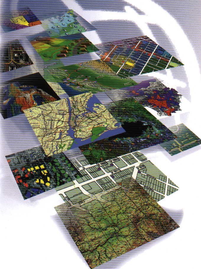
STATISTICS
DATA
TOPOGRAPHIC
MAPS
TOPOGRAPHIC
PLANS
Our team
Directorship
«Ұлттық картографиялық-геодезиялық қоры» is the place where you can be sure of the quality of the materials provided. We have a team of professionals who work hard to provide you with the best service and data.

KENBAYEV ALMAS
ADILBAEVICH
DIRECTOR
BRIEF BIOGRAPHY
Almas Adilbayevich Kenbayev was born on October 01, 1984 in Almaty.
In 2007, he graduated from the Kazakh National Technical University named after K. A. Satpayev with a degree in Astronomogeodesia.
In 2011, he graduated from the D. A. Kunaev University with a degree in Finance.
In 2020, he graduated from the International Educational Corporation of the Kazakh Head Architecture and Construction Academy with the qualification "Master of Technical Sciences".
He started his career in 2007.
From July 2007 to December 2013, he consistently held the positions of engineer-surveyor, head of office work of the State Border Delimitation and Demarcation Service of the Republic of Kazakhstan, head of the technical department of the Republican state-Owned Enterprise "Kazgeokart".
From December 2013 to September 2020, he held the position of Deputy Director for Production-Chief Engineer of the branch of the Republican state-owned Enterprise "Kazgeodeziya ""Kazgeokart".
Since December 2021, he has been appointed director of the branch of the Republican State Enterprise on the right of economic management "National Center of Geodesy and Spatial Information ""Ulttyk cartografiyalyk-geodeziyalyk kory".
He has the following awards: Badge/medal "Honorary Surveyor".
Has the following rewards: Letter of thanks from the Chairman of the Agency for Land Management.

YELISKINA TATIANA
ANATOLIEVNA
CHIEF ENGINEER
BRIEF BIOGRAPHY
Yeliskina Tatyana Anatolyevna was born on October 21, 1973 in the city of Dzhambul, Zhambyl region.
In 1993, she graduated from the Semipalatinsk Topographic Technical School, and was awarded the qualification "technician-aerial geodesist".
In 2008, she graduated from the International Educational Corporation of the Kazakh Head Art Architecture and Construction Academy with a degree in Applied Geodesy.
She started her career in 2003.
From August 2003 to September 2012, she worked as an engineer in "RKGP Yuzhgeodeziya", Taraz.
From August 2007 to October 2010, she worked remotely at DigitalORB, Almaty.
Head of the project actualization of Astana for the "Asian Games 2010" together with NAVITEL.
From September 2012 to September 2013, she held the position of editor-expert of the highest category in the National Cartographic Fund, Almaty.
Since September 2013, he has been working remotely as an engineer-surveyor in AFG Survey Capital LLP.
From October 2013 to December 2020, she successively held the position of editor-expert of the highest category and head of the department of expertise in the RSE "Kazgeodeziya", Almaty.
Since December 2020, she has been appointed to the position of chief Engineer of the Republican State Enterprise on the right of economic management "National Center of Geodesy and Spatial Information ""Ұлттық картографиялық-геодезиялық қоры".
Contact us
Contacts
Phone: +7 (727) 226 73 04
For questions about the online store: +7 (727) 226 73 05
E-mail: info@nkgf.kz
Address: 36, Esenberlin Street, Almaty
Working hours:
Monday to Friday 9:00 – 18:00